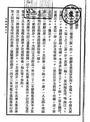
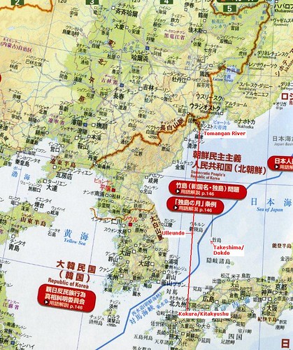
 日本海軍水路部が刊行したこの本は、英国海軍発行のChina Sea Pilot(Directory) を基本とし、独自の情報も斟酌して編集されました。この本の中で特筆すべきは、冒頭、第一編 総記において朝鮮国の東限が東経130度35分とされており、東経131度55分にある現竹島/Liancourt Rocksは明らかに同国の範囲外として明記されていることです。
総記
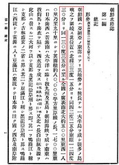
形勢
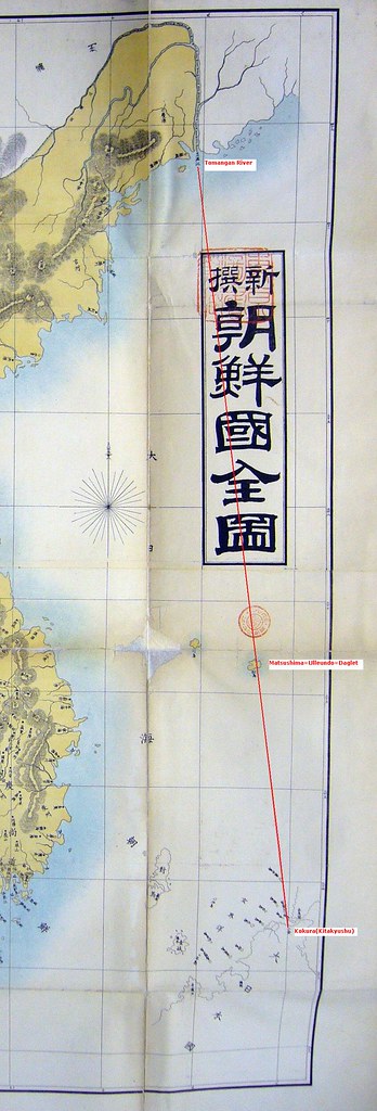
朝鮮国は亜細亜の東部にあり 其地勢たる狭長なる一大半島を成し 数多の島嶼 之を圍繞す
其位置は北緯三三度一五分より同四二度二五分 東経一二四度三〇分より同一三〇度三五分に至る
序文を書いているのは当時の海軍水路部長海軍大佐(Captain)肝付兼行です。彼は10年後の1904(明治三七)年も同じ水路局長の地位にあり、隠岐の中井養三郎が竹島の編入願いを提出するときに東京で相談を受け、現竹島がどの国にも属しておらず、日本の本土からの距離が朝鮮半島より近いため日本に属するのが適当と返答した人物です。本書がその総記において朝鮮国の東限を130度35分と明記して竹島/Liancourt Rocksを除外していた事実は、後の彼のこの言動と一致すると言えるでしょう。ちなみに、中井が東京で相談した山座円次郎 外務省政務局長、牧朴真 農商務省水産局長が、それぞれ最新韓国実業指針(1904年) と韓海通漁指針(1903年) という、同じく総記において朝鮮領土の東限を130度35分と明記した本の序文を書いていると言う事実も明確になっており、この三名が現竹島/Liancourt Rocksが朝鮮領土ではない事をはっきりと認識していた事を示す確たる証拠となっています。
これに対し、内藤正中氏はその著書等において、彼ら三人が序を寄せたそれぞれの本において、総記において朝鮮領土の東限を130度35分と竹島を朝鮮領土から除外している事実に全く触れることなく、現竹島が朝鮮東岸の日本海の岩嶼として、また江原道の項に挙げられていた事のみを挙げ、まるでこの三人が現竹島が朝鮮領である事を知りながら中井を唆して領土編入を願い出させたかのように、単なる憶測、しかも悪意さえも感じられる程の歪曲に基づいて論じており、韓国側もそうした自国に都合のよい言動を信用して大きく取り上げています。しかし当時、鬱陵島にはかなりの人数の日本人が居留(1902年時点で548名)しており、1900年代に入ってからは、隠岐より70km程近い位置にあった鬱陵島を拠点として現竹島へ出漁する事も多く、朝鮮半島周辺を航行する船舶への安全情報に加え、こうした朝鮮へ渡る漁民や実業家などの日本国民へむけて現竹島の情報を提供する事は、当然のことであったと思われます。しかも、当時の外務省通商局編纂「通商彙纂」(1902)などをみても、鬱陵島の日本人および朝鮮半島からの季節的漁民を含んだ当時の韓国人のいずれも、現竹島を韓国領と認識していた形跡は全くありません。これら3つの本の各項目については本来その領土を規定する為に書かれた物ではなく、船舶航行上の安全、韓国でのビジネスや漁業に乗り出す日本人のためのガイドブックというそれぞれの実用目的の為に執筆されている事が明確です。
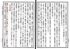
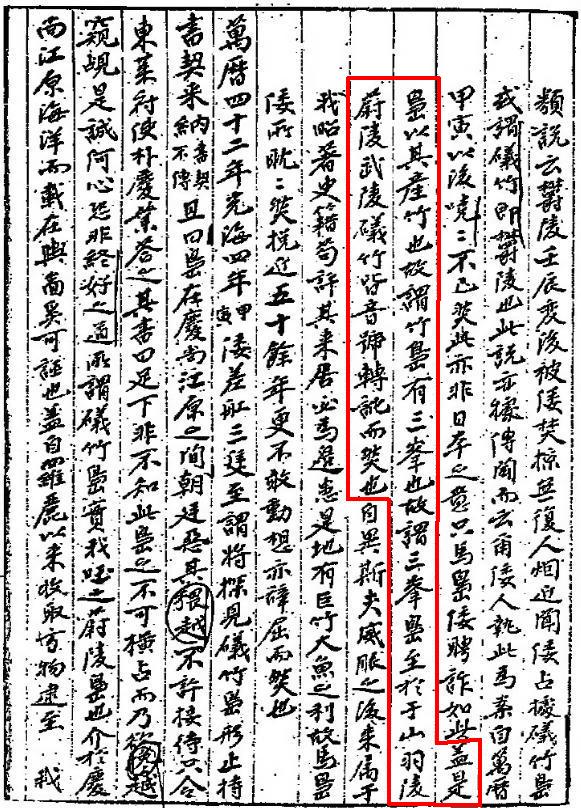
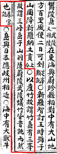
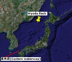
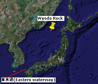 実際、本書においては第三編 朝鮮南西岸 朝鮮海峡 の最後に"西水道"、"東水道"がそれぞれ次の第四編に記される現竹島と同じ種類の項目として挙げられています。しかし、"西水道"は対馬と朝鮮国センチネール島の間の今日の朝鮮海峡ですが、"東水道"は対馬と壱岐の間の海峡であり、明らかに日本の領土内にあります。この事一つをとっても、各項目がそもそも領土を規定する為の目的で列記されたのではなく、例え日本の領土であっても当該国(朝鮮)沿岸に通漁する漁船などの船舶の安全航行の為に必要な情報を列記したものであることは明確です。さらに、第四編"リヤンコールト列岩"、"鬱陵島(一名松島)"に続いて記載されたワイオダ岩は、実際はその存在が確認されないもので1894年版の英海軍の水路誌にはその点が明記されいますが、いずれにせよ北緯41度14分30秒 東経137度14分 と、ロシア沿海州と北海道の間にあり、朝鮮国の領土から大きく外れているのに、全く同様に記載されている事からも、やはり本書の各項目が領土とは無関係である事は疑いの余地はありません。また、これらの項目は殆どが英国海軍発行の"China Sea Directory"からの翻訳であり、日本の海軍が朝鮮の領土として判断した上で記述していたとは考えられません。 しかも朝鮮東岸の日本海に注意すべき岩礁として列記されているに過ぎないことが、その記述から明確です。現竹島が江戸時代から鮑やアシカの好漁場として利用されてきただけでなく、江戸時代から鬱陵島への中継地点や道しるべとして、現竹島は日本の漁民や商船にとっては長らく日本海に浮かぶ大変重要な島の一つでした。
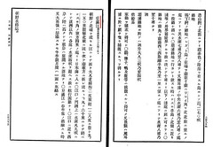
また、本書の総記において朝鮮国の東限が東経130度35分と現竹島を朝鮮領土から除外している事は先に記しました。ここで南限が北緯33度15分と、済州島から南に11km離れた所に位置する馬羅島(Mara-do)(北緯33度7分)を含んでいないことを持って、現竹嶋などの附属島嶼を本来含まない記述であるとする韓国側の反論があります。しかし、戦後竹島領有権を主張し始めた韓国政府に、理論的アドバイスをしていた歴史学者・崔南善は著書「朝鮮常識問答」(1946)で、次のように述べています 。
”問:我が国は地図上においてどの位置にあるか?””答:朝鮮半島自体は東経130度41分22秒から124度18分35秒、北緯34度14分16秒から43度0分36秒の間にある。大小の島を含めれば、東経130度56分23秒から124度11分00秒、北緯33度6分40秒から43度0分36秒の間にある。”“島嶼部を含むならば、最東端は慶尚北道鬱陵島竹島(竹嶼)(*訳注)、最西端は平安北道龍川郡薪島面馬鞍島、最南端は済州道大静面馬羅島、最北端は咸鏡北道穏城郡柔浦面である”
鬱陵島竹島とは、現竹島ではなく、韓国の古地図や文献において1700年代以降于山島として描かれ続けてきた鬱陵島の東2km沖に浮かぶ竹嶼です。また、同人による「朝鮮常識」(1948)でも島嶼を含めた韓国の東端が130度56分23秒であり、鬱陵島の隣接島である竹嶼(韓国名竹島)が韓国領土の東端で、極南が北緯33度6分40秒の馬羅島であると記しています。1948年においてさえ、馬羅島は領土として明記しているものの、現竹島(東経131度52分) は韓国領土から除外しています。つまり、本書に馬羅島を含まなかったことが、現竹島を鬱陵島附属島嶼として認識していた事を証明するものではないことが分かります。
また、この朝鮮国東限が鬱陵島ではなく豆満江を基準としていると言う指摘も見受けられますが、第四編の豆満江の項では、その朝鮮領土東限としての記述はおろか、河口である東端の経度の明記もありません。従ってやはりそのような指摘は、本書に関する限り事実に基づかない推測に過ぎない事が分かります。
以上のように、本書は日本海軍、特に水路局長肝付兼行が現竹島が朝鮮領土外である事を明確に認識していたという証拠であるとともに、実際はその東限とされた130度35分より東にあり、現竹島以上に戦略的に重要で実際に海底ケーブルも望楼も設置した鬱陵島を、強制的に編入などしなかった、1905年当時の明治政府が、内藤氏の主張するような領土拡大の野望を持って竹島の島根県編入を秘密裏に行ったようなのではなく、国際法に基づいた適切な対応をしていた事を証明する貴重な資料でもあると言えるでしょう。
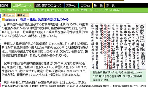
新羅時代から1948年に至るまで現竹島をその領土内として認識していた明らかな形跡がただの一つもないのにも関わらず、竹島だけでなく対馬、さらには波浪島と言う存在があやふやな島までその領土に編入する事を要求した上に、サンフランシスコ条約締結直前三ヶ月前に突然所謂李ラインと言う国際的ルールに基づかない国境を一方的に画定し竹島を不法占拠し、それを越える日本漁船を一方的に機関銃等で銃撃(2007年7月5日 山陰中央新報 )(魚拓)するなどし、日本の漁民44名を死傷させるに至らしめ、約四千人を拿捕、抑留した上日韓交渉を有利に進める人質外交を行った韓国こそが、侵略的な領土拡大という国際的犯罪行為を行った張本人であることは明確です。韓国が1905年の明治政府による平和的な島根県への編入を、本来無関係である帝国主義にことさら結びつけて愛国心を煽り、自国に有利な世論に持ち込もうと必死なのは、こうした都合の悪い事実を覆い隠そうとする意図があるのでしょうか。
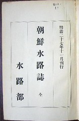
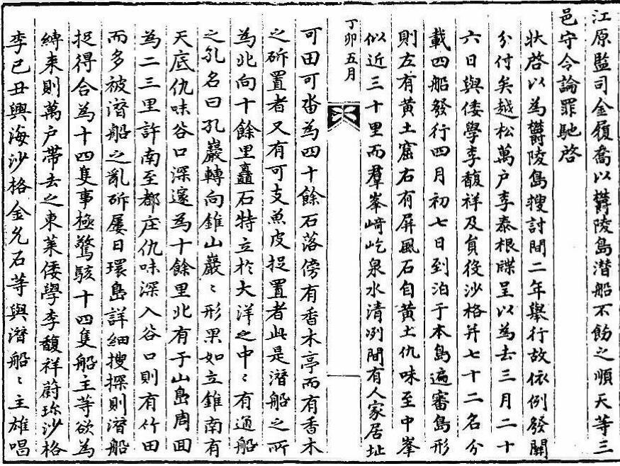
「朝鮮水路誌」(明治二十七年)の全文は国立国会図書館のホームページ から閲覧可能です。


